
USFA Analysis Hypotheses
Wildfire Report Series: MODIS-Detected Fires in NFIRS
Hypotheses Regarding Non-Matching MODIS Incidents
There were 77,054 MODIS incidents in 2017. Of the MODIS incidents, 4,931 occurred in national parks or national forests, grasslands, or wilderness areas. Another 1,212 of them occurred within 24 hours and 1 kilometer of a fire that was reported in NFIRS (including 20 that included land in the selected federal areas). That leaves 70,931 MODIS incidents, 92% of the total, that are not accounted for in NFIRS data.
Some of these remaining MODIS incidents may have occurred in other types of public land that we did not examine, such as areas controlled by the Bureau of Land Management or Bureau of Reclamation. Some may have occurred in state parks and forests, and some may have occurred in unpopulated, privately owned land.
73% of MODIS incidents were observed once and at 1 location. MODIS generally detects fires that have a radius of 18 meters and can detect fires with a radius as small as 4 meters. These could be examples of authorized or unauthorized fires that are set to clear crop land or burn trash that are quickly extinguished, so no fire department intervention is needed.
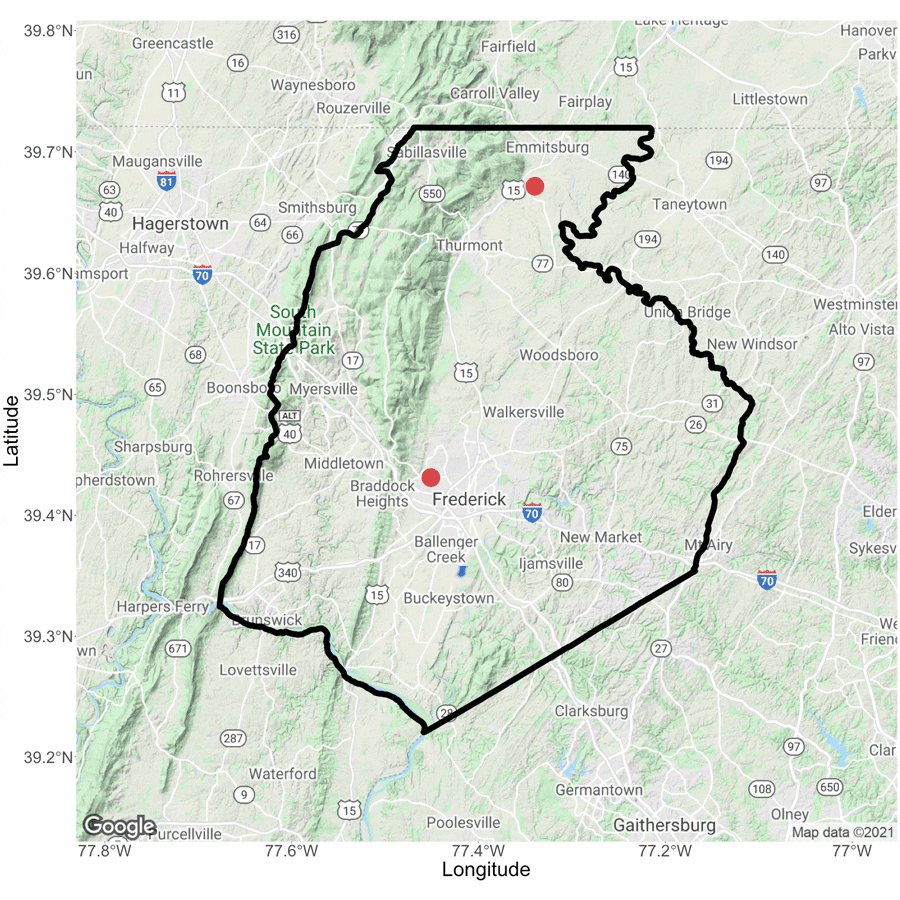
We examined 3 MODIS observations for Frederick County, Maryland, and were surprised to see that they were of solar farms (Figure 5). MODIS' detection algorithm relies on the heat signature emanating from an area, and it is possible that these objects created a false positive under the right conditions.
Figure 5: MODIS Observations in Frederick County, Maryland
Unmatched MODIS Observations, Frederick County, Maryland
The data for the figure is based on MODIS data retrieved from https://firms2.modaps.eosdis.nasa.gov/download/ and excludes incidents where the Type is “other static land source.”
Select the indicators below to view the observations.
- Imagery (c)2021 Maxar Technologies, U.S. Geological Survey, USDA Farm Service Agency. Map data (c)2021.
- Imagery (c)2021 Commonwealth of Virginia, Maxar Technologies, U.S. Geological Survey, USDA Farm Service Agency. Map data (c)2021.

