WUI Research and Technology
Research projects exploring new and emerging technology to support wildland fire incident response and save lives.
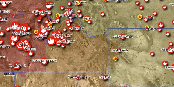
Senior Leadership Dashboard
The Senior Leadership Dashboard summarizes current national wildfire activity. It uses the most authoritative, publicly available data services to provide insights on wildfire activity over the past 7 days and historical wildfire trends over the past 10 years.

2 New Apps Can Raise Wildfire Risk Awareness in Your Community
The U.S. Fire Administration has developed 2 new tools you can use to improve prevention messaging in your community. The 2 tools are the Wildland Urban Interface (WUI) Fire Property Awareness Explorer and the WUI Fire Community Awareness Explorer. They provide the initial data-informed basis for residents to “Know Where You Live” in proximity to the location of the WUI and fire-prone areas.
Raising awareness is the first step and serves as the starting point for residents to take action in preparing for and mitigating wildfire loss.

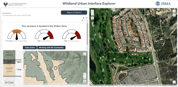
WUI Fire Property Awareness Explorer Application
This application allows users to search addresses or communities to gain a contextual understanding of their area relative to the WUI and vegetative fuels. The application also includes an assessment of a location's structure density and proximity - important factors to consider for creating fire-adapted communities in the WUI and for developing mitigation plans and outreach campaigns.

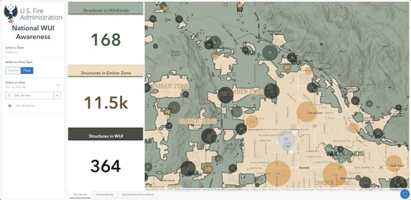
WUI Fire Community Awareness Explorer
This dashboard provides a quick snapshot of counties or places in the US and potential exposure to wildfire hazards for structures in the WUI. Users interested in building fire-adapted communities and resilience can quickly identify vulnerable structures or areas in the WUI to help inform community risk reduction planning and targeted outreach efforts.
Disclaimer: These tools do not measure or convey risk. Rather, they are designed to raise awareness about the location of the wildland-urban interface (WUI) and the potential susceptibility to fire in areas relative to wildfire hazard exposure. The parameters for the WUI visualized within these tools represent examples informed by available research and data but should not be construed as requirements or absolute values. Users of these tools should consider whether seasonal, temporal, spatial, topographical and climatological conditions could influence the results of their assessments and consider making any necessary modifications to suit their particular needs.
Research projects
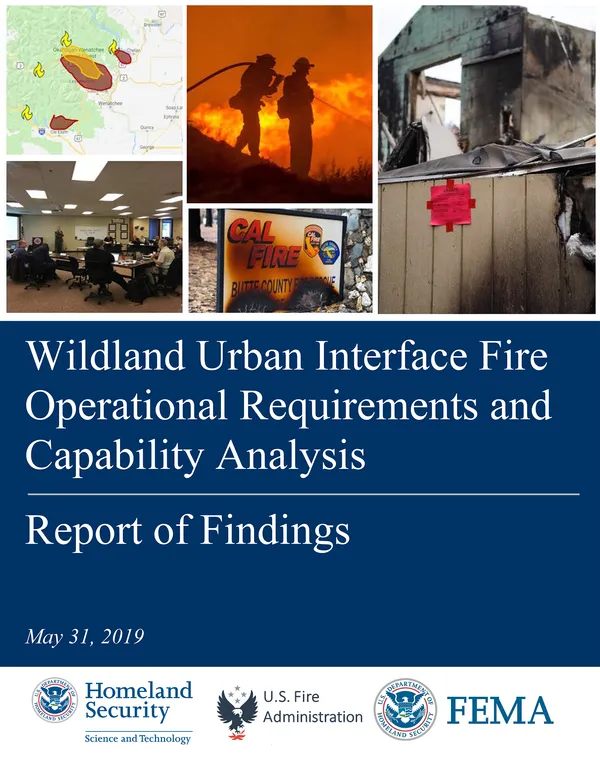
WUI Fire Operational Requirements and Capability Analysis: Report of Findings
Following the loss of life from the 2017 California wildfires in Santa Rosa and Ventura, the USFA began collaborating with the Department of Homeland Security's Science and Technology (S&T) directorate to research new and emerging technology that could be applied to wildland fire incident response.
Improving operational capabilities and incident response were the initial focus. Several other areas of innovation were also identified related to wildland fire preparedness and mitigation and enhanced wildland fire suppression practices, including resistant infrastructure planning, building materials and building codes.
The projects listed on this page are a summary of completed and ongoing work that USFA supports and collaborates on with S&T and other partners.

Report
WUI Fire Operational Requirements and Capability Analysis: Report of Findings
This report summarizes the key findings from research focused on improving operational capabilities and incident response to save lives in WUI fires.
Team Awareness Kit (TAK) app
TAK is a free-to-use GPS communications tool for mobile devices to improve situational awareness. Originally developed for special forces, it is available to fire personnel on iOS (iTAK) and Android (ATAK) devices.
How this project helps the fire service: TAK allows firefighters to see each other's locations, and communicate and coordinate better in a complex WUI environment.
Wildland fire sensors
A project to develop a suite of sensors, platforms and other early wildfire detection technologies to assist the Federal Emergency Management Agency and state and local emergency management partners in wildfire response.
How this project helps the fire service: Early, targeted warning of these fire events is critical for improved fire response and public and firefighter safety.
Augmented reality wildfire home safety app
The app, free and available in the App Store or Google Play, allows users to scan a property with their mobile device and instantly be made aware of tips to improve home survival in the event of a wildfire. While scanning, it identifies components of the home at ignition risk during a wildfire event and gives the user steps to take to mitigate any fire risks.
How this project helps the fire service: Fire prevention officers can use the app in the field to promote interactive conversations about wildfire safety actions.
Structure separation experiments
The National Institute of Standards and Technology (NIST), USFA and other agency partners are conducting a multi-year phased series of full-scale fire experiments to assess safe structure separation distances between different types of auxiliary and residential structures. Fire spread from structure to structure is often a major factor in large-loss WUI fire events.
Measurement of flame lengths, heat fluxes, and temperatures generated from burning structures ranging from small sheds to neighboring residences will support parcel-level spacing guidance, structure hardening guidance, and the development of more representative test methods of fuels and mitigation pathways implemented in the WUI. Results may be used by authorities having jurisdiction nationwide to define or refine structure separation requirements and building and fire codes in both WUI and non-WUI environments.
How this project helps the fire service: Research results can help to inform fire and building codes officials about structure separation and safety in WUI communities.
