
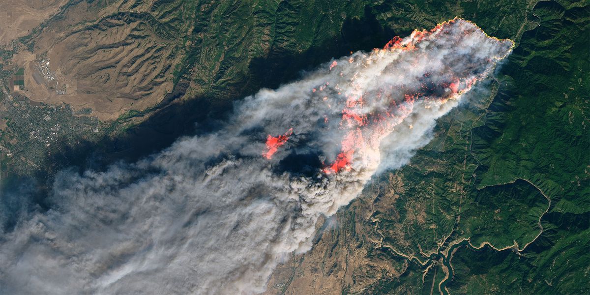
Photo credit: NASA (Camp Fire, November 8, 2018)
NASA Satellite Images Identify a Destructive Wildfire Metric
Posted: Jan. 17, 2025
- 2 min read
- Find similar articles:
- Wildfire and WUI
- Data
- Equipment and Technology
- Fire Investigation
University of Colorado research scientists completed a new study based on data provided by satellite images of wildfire behavior. The study offers some interesting insights that have the potential to significantly improve future wildfire management, helping first responders and communities plan for and respond more safely and efficiently to wildfires.
The study conducted a comprehensive analysis using 2 decades of data. The research team examined a staggering 60,000 wildfires observed by NASA Aqua and Terra satellites, providing a robust foundation for their findings.
The scientists determined from the examined images that wildfires driven by high winds, particularly in ecosystems such as grasslands and shrubland affected by drought and/or elevated temperatures that cause the vegetation to dry out, can become “fast fires.” This category of wildfire is defined as having a spread rate of 6 square miles a day. They often occur during autumn or winter but can burn at any time of the year.
Research has shown that this growing trend in wildfire behavior is more destructive and deadly. Fast fires currently account for 3% of all wildfires in the nation, causing 89% of damage, 66% of deaths, and $18.9 billion in suppression costs.
Some of the deadly fast fires identified in the study include the Camp Fire in California, the Lahaina Fire in Maui, the Marshal Fire in Colorado, and the Northwest Oklahoma Complex Fire that burned an area the size of Rhode Island, killed eight people, and caused the destruction of 4,000 cattle and 151 structures.
The study concludes with the recommendation that more research is needed to determine the contributing factors to this growing trend. It suggests that a collaborative effort involving researchers, policymakers, and emergency responders is crucial to understanding the complex interplay of factors leading to fast fires. Are fast fires due to changing climatic conditions, increased human-caused ignitions (including downed power lines), the conversion of natural ecosystems to invasive grasses and other flashy vegetative fuels, or a combination of effects? Understanding this is key to better planning, preparation, and action to mitigate exposure to communities and prevent loss from these wildfire events.
Gaining a better understanding of contributing conditions can help communities, first responders, and other emergency service personnel better plan (including evacuation planning), prepare for, and take action to mitigate exposure to communities and more effectively prevent loss from these wildfire events.